THE GREATEST DAY ALONE
On Friday, November 4, 2022 I completed an ascent of San Jacinto Peak via the Skyline Trail. The famed name of this is Cactus-to-Clouds. It is a point-to-point hike of about 21 miles with an elevation gain of 10,819 vertical feet. It starts at a trailhead in downtown Palm Springs, California and summits the peak at 10,834 feet, then descends to finish at the top of the Palm Springs Tramway. I would take the tram back down.
I committed about 10 weeks prior, and I trained for it in the same manner I did for many triathlons and other endurance events. The training involved getting in the best climbing condition I could, planning my ascent, and being prepared by utilizing the proper gear correctly.
I studied the trail, the aspects, and the elevations. I broke the route down into segments based on landmarks and their elevations on a topo map with expected times and cutoff times, at which point, if I did not meet them, I would turn around.
I also studied the weather patterns and temperatures this time of the year using mountaineering websites and local weather models. The most helpful website was mountain-forecast.com.
I created this simulation with landmarks using a 3-map from Alltrails.com
This is a rough scale along with my landmarks. The elevations are more accurate than the distances. This is mostly due to the variations in the switchbacks along the skyline trail.
This is an expanded view of the weather, along with temps, windchill, freeze line, wind speed and direction.
Solo ascent
Total Time: 11hr 31min
Moving Time: 9hr 51min
I was planning on being on the trailhead at 4:00am so I would have plenty of day light at the end of the day, as I hate hiking into the dark. I started to shift my sleeping schedule accordingly by being in bed by 8:00pm a few weeks prior and getting up and hiking or running at 4:00 am. I went to bed at 7:00 and by 12:30 I could not sleep so I woke up, checked emails, ate break fast and got on the trail at 2:21 AM. I hiked by the the light of my headlamp for 4 hours until sunrise. Training with a headlamp before sunrise makes this quite familiar and actually rather comfortable.
I used the new Apple Watch Ultra and navigation through Strava and Alltrails apps linked to the watch. This is the single best piece of equipment I brought. I used Black Diamond trekking poles, and carried a 26 lb Black Diamond pack with food, a 3liter bladder of water, 2 x.5liter soft flasks of water, gloves, first aid kit, solar charger, extra headlamp, extra clothing layers, Yak-trax micro spikes. Just in case technology failed I carried and compass and a topo map of the massif. Every piece of clothing I had on can be found on desotosport.com. I wore Helly Hansen Cascade hiking shoes and brought a 45-year old set of Vuarnet Cateye 02 sunglasses with brown lens.
I stopped every hour for 5 minutes to pee/hydrate/refuel/assess clothing etc. I started with 4 liters of water, drank a 500ml flask at a time each hour, and refueled 1 liter at the Ranger Station on way up to the peak. I bought dried banana chips and fig bars to snack on breakfast at the Ranger Station.
The tricky part of this ascent is that many parts a quite steep, and the more I climbed, the thinner the air got, which forces one to slow down. The summit was 34°F, no breeze, absolute perfection.
I did not see a single person until about 12:15 in the afternoon on my return trip down. This ascent is not difficult if you plan properly and take it in segments as I did. It was not a race for me other than to finish before dark. I did that we 4 hours to spare, but I would never start any later on any ascent. I liked alone and not seeing anybody on the way up. It was one of the best days I have ever spent alone, and I enjoyed every minute of it.
2:21 AM: Trailhead: 459ft 44° F
The view of the Coachella Valley was amazing in the first 200 feet
An hour later even more beautiful:
3:36 AM: Rescue Box 1: 2340ft
4:50 AM: Stack of Rocks: 4300ft
5:57 AM: Rescue Box 2: 5400ft
Temps dipped into the low 20°’s at Flat Rock(5900) and I saw first snow on ground at about 6700 feet. It had snowed 20 hours before my ascent. The freeze line stayed below this altitude, so the snow was dry, and grippy, and did not need to dawn micro spikes. I was not out to race this thing, so moving time is much less than start-to-finish time.
6:26 AM: Flat Rock: 5900ft 20°F (red sky at dawn)
Dawn's light on the granite that is Flat Rock
First snow at 6700ft
7:27 AM: Start of Traverse: 7400ft
Coffman's Craig is the sign to turn and start up the steepest pitch of the day through the boulder field.
As you scramble up the boulder field, some parts require you to put your poles away and use your hands to balance on, or walk between, the boulders.
The blue sky through the trees, is a welcomed indication you are reaching the first summit at 8400 feet.
8:22 AM: Grubb’s Notch and the entrance to Long Valley: 8400ft when you get here you have about another 2500 vertical in 5 miles to the summit.
8:29 AM: Ranger Station: 8400ft (water, made lunch, filled out permit)
turkey bacon and cheese on a baguette
10:19 AM: Wellman Divide: 9700ft (2.7 miles and 1100 vert feet to the San Jacinto Peak)
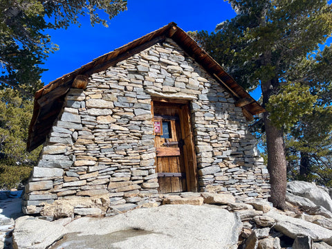
11:27 AM: Emergency Hut: 10,700ft
11:34 AM: Summit: 10,834ft 34°F Official proof
snow capped trees 34°F at the summit
1:42 PM: Tram Station in time for lunch, a bowl of clam chowder and a Corona: 8516ft
A special thanks to my friend, David Preston, for picking me up at the base of the Tramway and taking me back to my car.


6 comments
Thanks for the great journal of your adventure. Sure we are slowing down, but that can also be a good thing. Taking time to smell the flowers and absorb more of the nature all around us. I like that you did it solo. A very long day of meditation for sure! See you around…
Impressive. Next? Three Peak Challenge – Baldy Gorgonio Jacinto – in 24 hours; Baldy Run to the Top. Or, San Diego to Vancouver off-road on Mtn.Bike
flogil.travelmap.net
(left arrow for map, zoom)
Great recap and info for a possible ascent
Good job and thanks